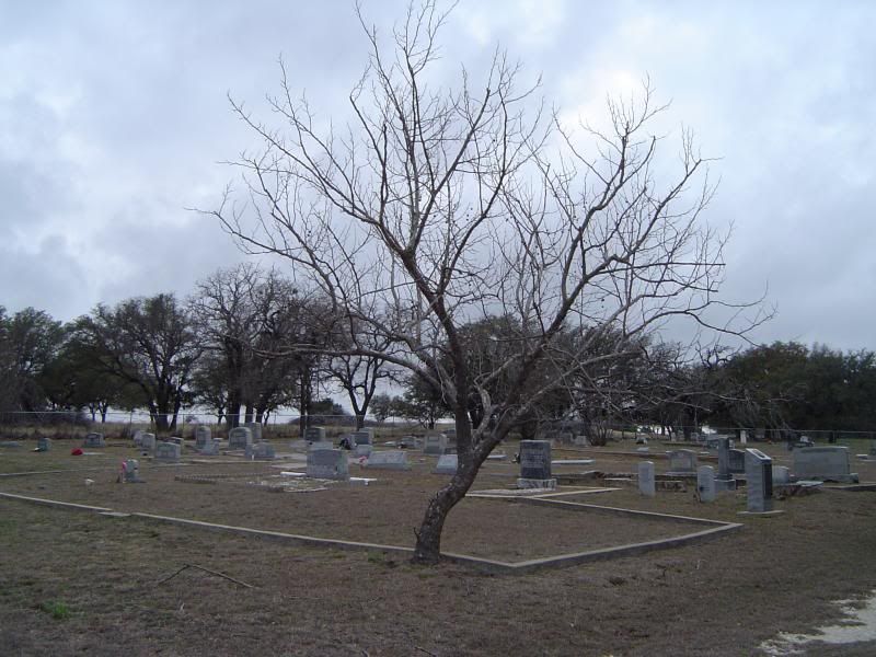
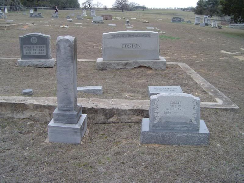
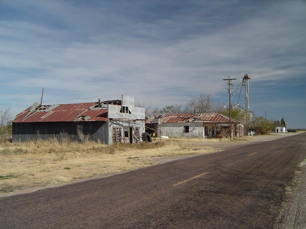
Some of you may remember my photos of the Montague County ghost town of Belcherville from 2010-2011. I finally had a chance to take a friend of mine on a ghost town expedition through Cooke County and Montague County over the weekend after returning to college in January, and since Belcherville was the first Texas ghost town I ever discovered, I had to put it on our itinerary.
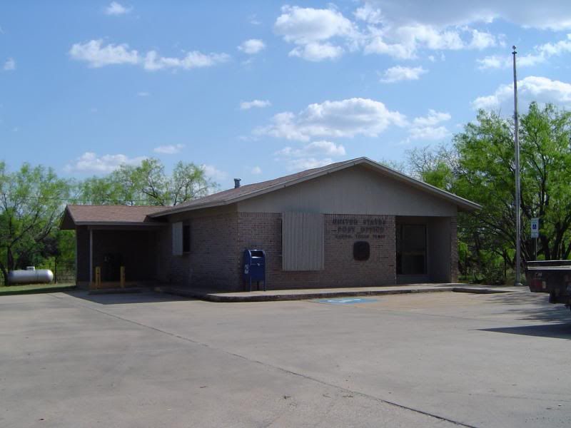
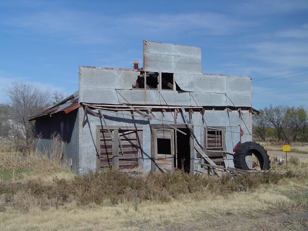
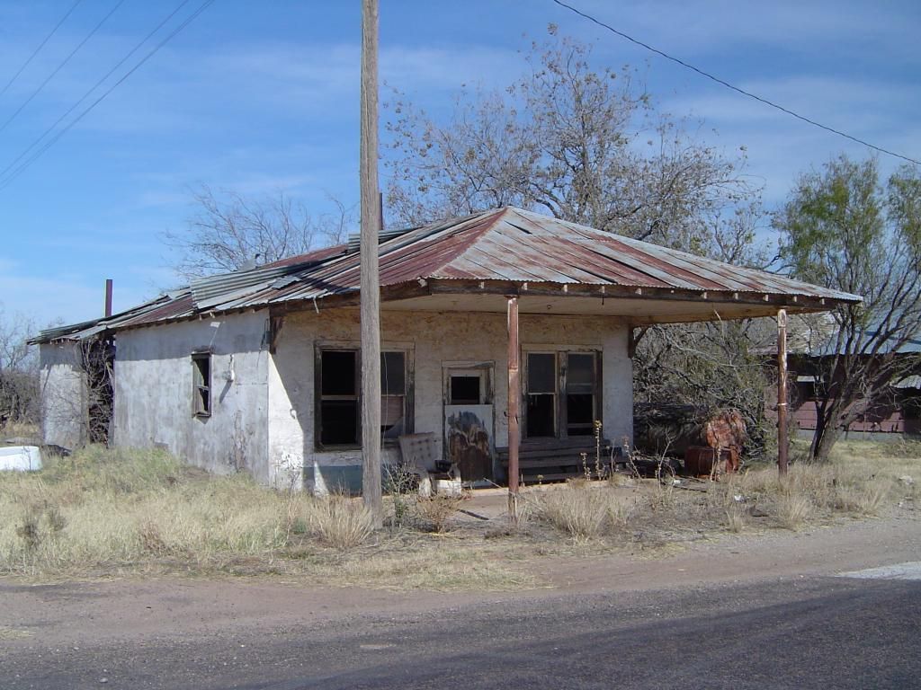
When we got out to the site, there were some drastic changes. A sturdy fence with numerous "No Trespassing" signs has been erected around much of downtown Belcherville, putting the remains of at least two churches and the Manley homestead on Elm Street off limits. In addition, the Vannoy gas station off Highway 82 has been wiped off the face of the earth. All that appears to be accessible in the original townsite are the old post office and the cemetery.
This appears to mark the imminent demise of the old Belcherville site for all time. My guess is the former downtown area will be razed and converted into farmland. Belcherville's population remains tiny, but the town also remains incorporated - the smallest incorporated city anywhere in the state of Texas. The locals have developed some farms and ranches on the old site, and it looks like we've stumbled upon the latest phase in what appears to be Belcherville's transformation from a collection of abandoned buildings into a quiet, dispersed farming community.
If anyone has further information on these developments, please feel free to share.
Showing posts with label Texas. Show all posts
Showing posts with label Texas. Show all posts
Sunday, July 19, 2015
Sunday, July 20, 2014
Dexter (Cooke County) - April 2012 photos
I haven't been on a ghost town expedition for quite some time due to financial and personal constraints, and I miss being out on the road, exploring abandoned towns throughout Texas and bringing you pictures of what's left of these forgotten communities. Still, it turns out I still have a bunch of photos I haven't shared with you yet, and one set of photos is of the Cooke County town of Dexter, reduced to a mere shell of its former self. I don't know why, but I've been sitting on these photos for over two years - guess it's time I shared the history of Dexter with you, right?
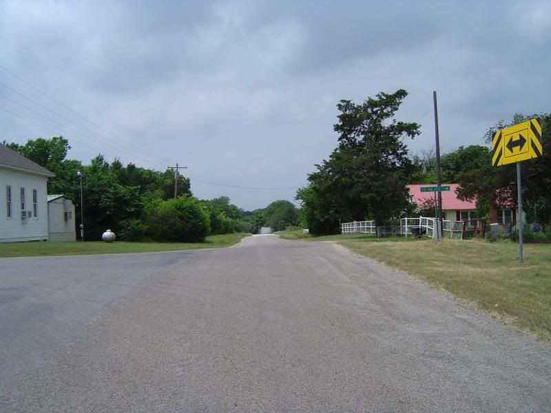
County Road 106, winding through what used to be the heart of Dexter
Take a good look at the above image of Dexter's now-quiet main street. Over a hundred years ago, what Gainesville is today, Dexter once aspired to be - the most important stop on the road north before crossing the Red River into Oklahoma. The Captured by Jess blog features a picture of Dexter in its heyday, and I strongly encourage you to visit Jessica's blog for that photo as well as other great shots of what's left of this once-ambitious town. If you wish to visit Dexter yourself, it's approximately 10 miles north of Callisburg on County Road 678 in extreme northeastern Cooke County; when you reach the intersection with County Road 106 and see the church on your left, you have arrived.
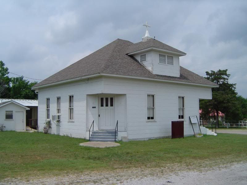
Dexter Community Church, still in use today
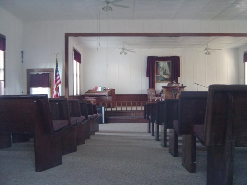
A peek inside Dexter Community Church
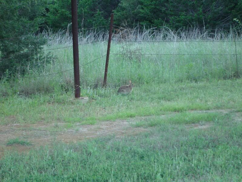
Look closely to see my little furry friend romping the church grounds at Dexter
Dexter's life as a bustling border town was short, but marked by aggressive growth. Founded around 1870 by Dick Collum, S.E. Collum, Jesse Morris, and Bill Munday, it was originally located about three miles east of its present location, next to a natural spring that was certain to draw travellers. The site was originally called Sugar Hill, but Jesse Morris is credited with renaming the town Dexter after a once-famous racehorse.
Jason Schall inaugurated Dexter's post office on March 31, 1873, and the town quickly blossomed afterwards, reaching a population of 300 in the early 1880s. By that time, Dexter was home to 37 businesses, including its own district school, four blacksmith shops, four physicians, three hotels, two steam gristmills and cotton gins, a bank, a barber shop, and at least one church. The rapid growth of Dexter did not go unnoticed by Gainesville, which had become a supply point for cowboys headed north to Kansas with herds of cattle in tow.
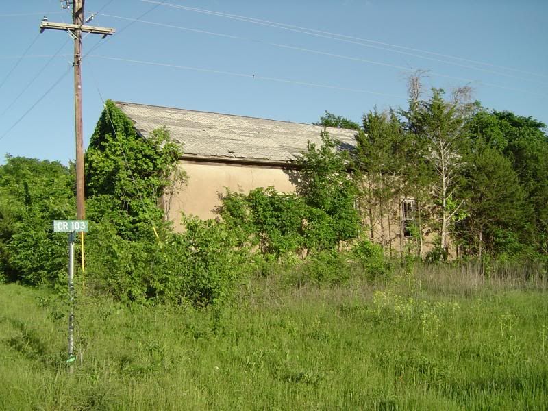
Side view of Dexter's school auditorium
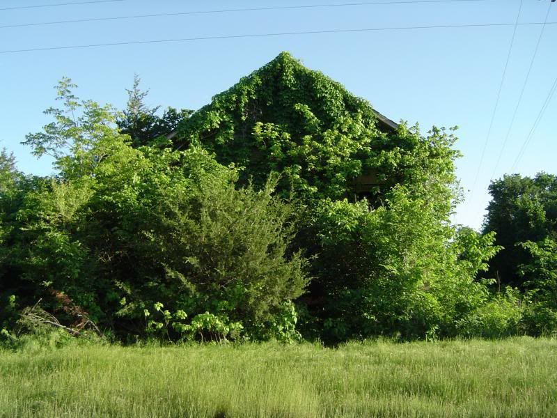
Front view of Dexter's school auditorium
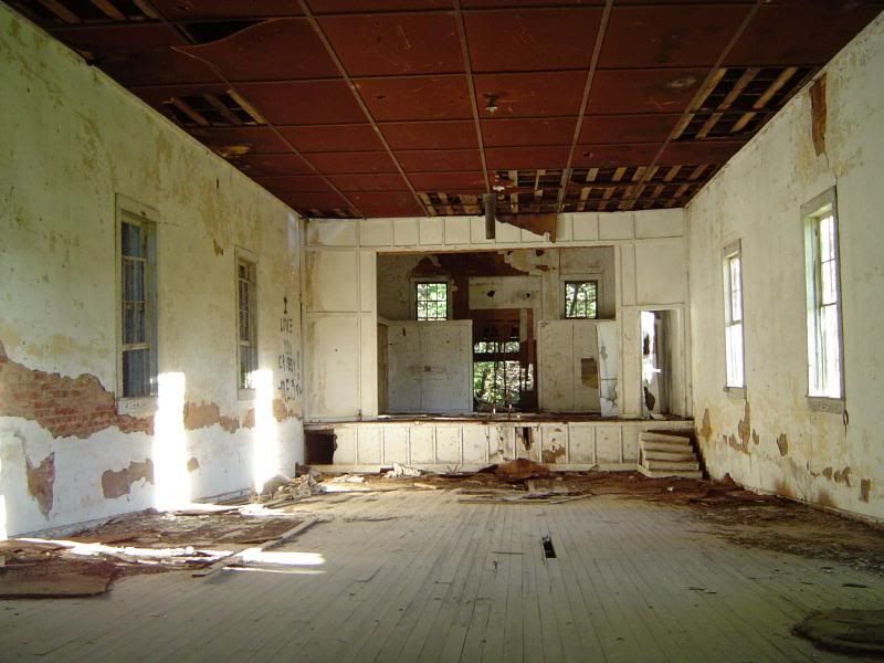
A peek inside Dexter's school auditorium
Every town in Cooke County anticipated the coming of the railroad, hoping to be the first town in the county to welcome trains to its own depot. The townfolk of Dexter were apparently convinced that the Denison and Pacific Railway was going to lay tracks right through their town, but as luck would have it, the railway instead chose to build through the town of Woodbine, 20 miles south of Dexter. Stung but undaunted by the financial loss, Dexter held a vote on February 28, 1885 on incorporation; turnout was somewhat light, but the town incorporated on a 30-18 vote. It was nevertheless becoming obvious to Dexter's denizens that the town was declining, with many of its businesses moving north of the Red River to resettle in Ardmore, Oklahoma. Dexter was also beginning to attract a more unsavory lot who occasionally used the town as a hideout; a posse tracked down brothers James and Pink Lee of the Lee Gang to a hayfield near Dexter on September 7, 1885, where both brothers were killed in a gunfight.
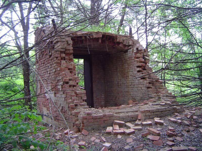
Rear view of the abandoned bank vault at Dexter, now hidden from the road by dense foliage
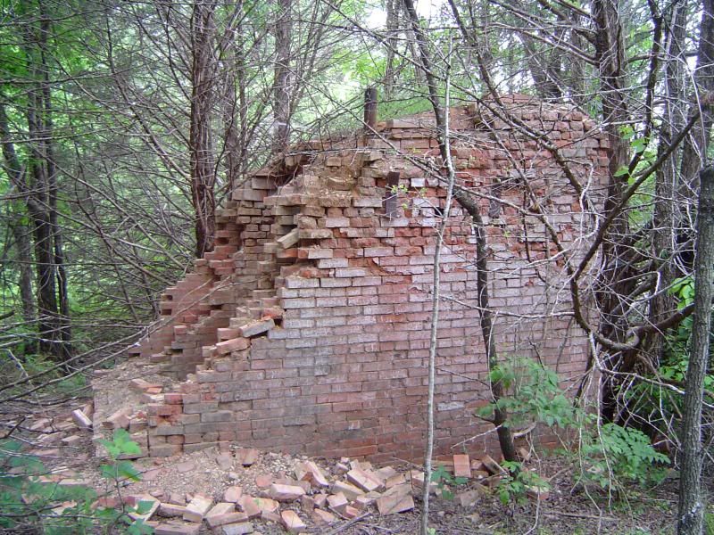
Side view of the Dexter bank vault
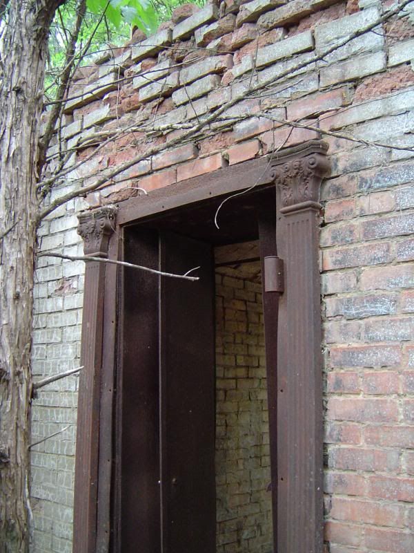
Detail of ironwork molding around front door to the Dexter bank vault
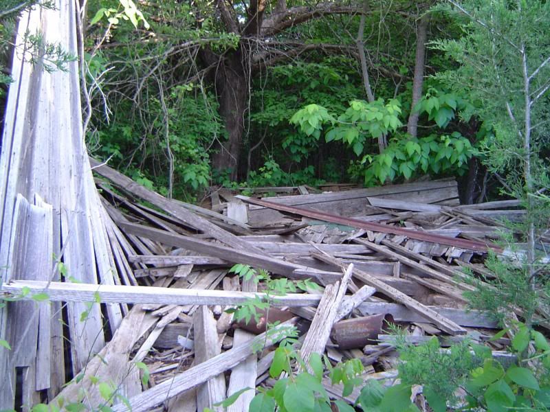
Remains of a wooden shack that reportedly housed the barber shop; said to have finally collapsed around 2000
The city government of Dexter managed to hold out until around 1900, and the post office was apparently discontinued sometime after 1925. The population continued to decline until 70 people were left at the townsite from the late 1960s until 1987, when the population began to plummet even further. The 2000 census reported only 18 people left at what used to be Cooke County's most ambitious town.
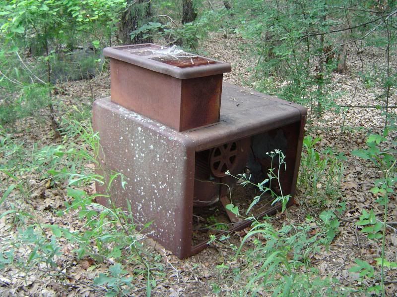
Rusting machinery reposing in the vicinity of what used to be Dexter's general store
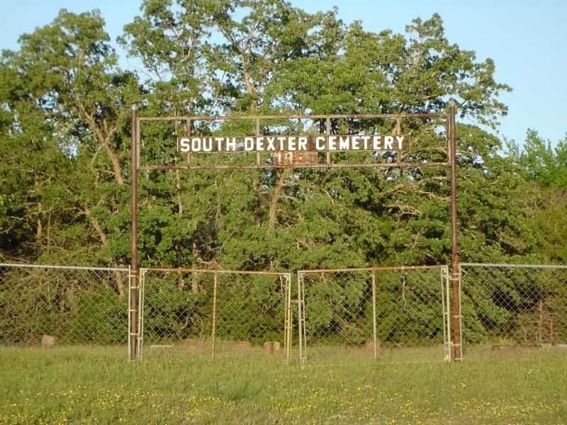
Gate to South Dexter Cemetery - unlike many Texas ghost towns, Dexter has two cemeteries instead of just one
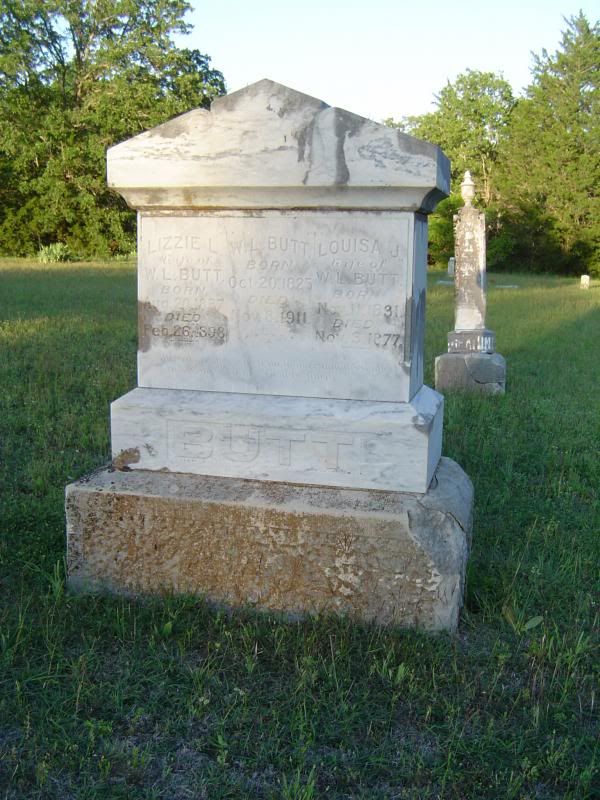
Tombstone for W.L. Butt and his two wives, located in South Dexter Cemetery
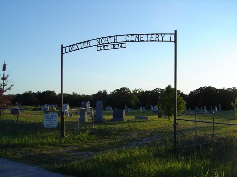
Gate to Dexter North Cemetery - or North Dexter Cemetery, depending on whether you believe the gate or the nearby sign
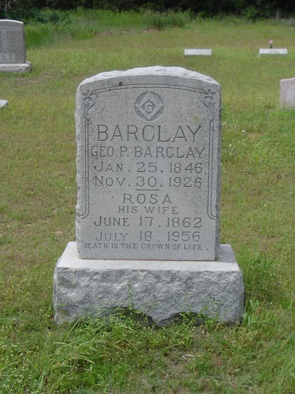
Masonic gravestone for George P. Barclay and wife Rosa, located in Dexter North Cemetery
I hope you enjoyed this pictorial essay of Dexter. If you choose to visit this ghost town yourself, most of the roads are paved, but be advised that some of the roads are gravel and dirt that are prone to bumps and ditches and may be impassable after recent rainfall. Be safe, stay hydrated, and enjoy - and thank you for learning about the history of Dexter!
One more thing: Happy Birthday to my brother Steve! Love you, bro!
Tuesday, February 18, 2014
Mantua (Collin County) - February 2014 photos
Once upon a time, I talked about ghost towns in Texas that have completely vanished from the map, preserved only in the memories of historians and those whose ancestors lived in these communities. Those of you who live in the Dallas/Fort Worth area probably noticed substantial population growth in Collin County over the past 25 years, but as cities such as Frisco, McKinney, and Plano continue to expand and flourish, there is one town on the northern edge of Collin County that has, for all intents and purposes, disappeared.
Mantua (pronounced MAN-too-AY in case you were wondering) was one of the oldest towns in Collin County. Mantua was born in 1854 when a delegation that included James Webb Throckmorton, a state legislator and future Texas governor, purchased 200 acres from one of the sons of Texas hero Collin McKinney; on February 23 of that year, the delegation set aside 25 of those acres for development of a town and a seminary. Proceeds from the sale of town lots were intended to finance construction of the seminary, and in order to ensure a less ungodly environment in which the seminary could operate, Mantua's town fathers forbade gambling, horse racing, prostitution, and sales of alcohol.
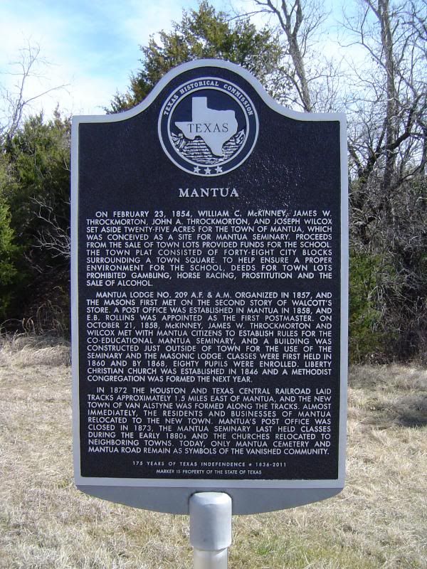
Historical marker at the townsite of Mantua, near the intersection of US 75 and Mantua Road in Collin County
Masonic Lodge No. 209, which sponsored the seminary, organized on February 7, 1857, on the second floor of Horatio N. Walcott's store building in Mantua. The town received its own post office the following year, with E. B. Rollins serving as the first postmaster. In 1859, a new two-story building was constructed at Mantua, with the upper floor used by the lodge for meetings and the lower floor serving as the Mantua Seminary, which educated male and female students alike. In 1860, Mantua boasted a Disciples of Christ church, three stores, and a population of 50 in addition to the seminary and lodge. By 1870, the population of Mantua had increased to 300.
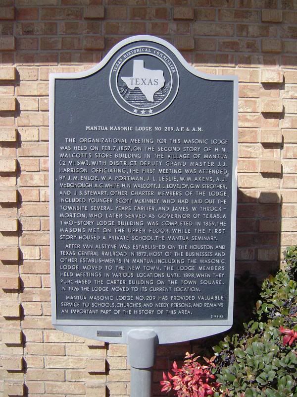
Historical marker for Mantua Masonic Lodge No. 209, vital to the development of Mantua
Just as Mantua's long-term prospects were looking up, though, it suffered a fate shared by many forgotten Texas towns in those days - death by railroad. The Houston and Texas Central Railway purchased land in neighboring Grayson County for $20 an acre from the great-grandson of Collin McKinney in 1872, laying tracks through the region that sat around one and a half miles east of the town. A new depot town called Van Alstyne was established on the railroad line just over the county line in Grayson County. The death of Mantua came quickly, with some residents of Mantua quickly snatching up land at Van Alstyne. By the end of 1873, Mantua had lost its businesses, the post office, the lodge, and most of its population to the new town; the church stayed put until 1888.
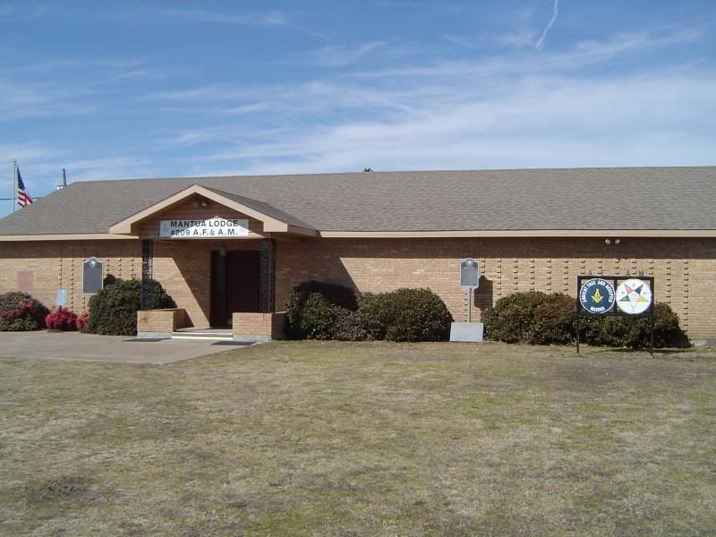
The Mantua Lodge at its current digs in Van Alstyne in Grayson County
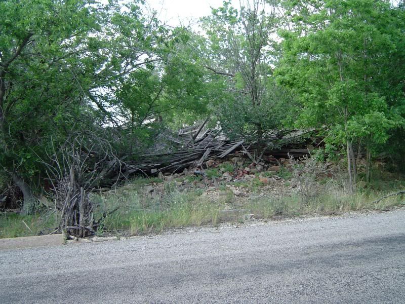
County Road 371, which winds along the northern edge of Collin County, is still identified as Mantua Road, as this is the road that the town was developed on. Today, however, there is absolutely no trace of the old town on CR 371, which has been converted into farmland and housing developments. A historical marker erected on the western edge of the old townsite indicates that there is also a Mantua Cemetery that carries the name of the forgotten community, but a descendant of one of the town's residents has informed me that the cemetery, which was always quite small to begin with, now sits on private property and cannot be viewed from the road; I have also been unable to pinpoint the cemetery's location with satellite images. In fact, the only tangible evidence of what might have been part of Mantua was found after marching through various trees and thorns to discover what looks like a small collapsed structure on the banks of a winding creek.
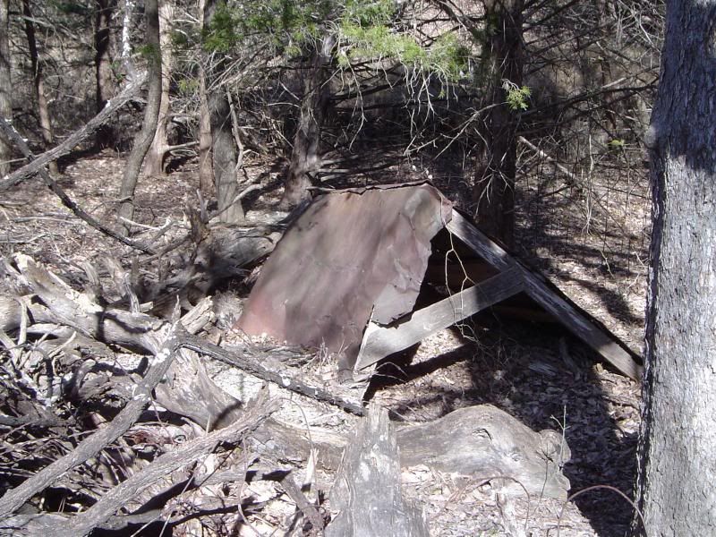
The final, forlorn remnants of Mantua?
If anyone has information on what this building once was, please share - it will certainly be appreciated. But it is somewhat poignant that this growing seminary town has become such a complete ghost that only a historical marker and a county road bear testimony to its former existence over 125 years later. In another 125 years, will even historians and descendants of the townfolk remember the little town of Mantua?
Mantua (pronounced MAN-too-AY in case you were wondering) was one of the oldest towns in Collin County. Mantua was born in 1854 when a delegation that included James Webb Throckmorton, a state legislator and future Texas governor, purchased 200 acres from one of the sons of Texas hero Collin McKinney; on February 23 of that year, the delegation set aside 25 of those acres for development of a town and a seminary. Proceeds from the sale of town lots were intended to finance construction of the seminary, and in order to ensure a less ungodly environment in which the seminary could operate, Mantua's town fathers forbade gambling, horse racing, prostitution, and sales of alcohol.
Historical marker at the townsite of Mantua, near the intersection of US 75 and Mantua Road in Collin County
Masonic Lodge No. 209, which sponsored the seminary, organized on February 7, 1857, on the second floor of Horatio N. Walcott's store building in Mantua. The town received its own post office the following year, with E. B. Rollins serving as the first postmaster. In 1859, a new two-story building was constructed at Mantua, with the upper floor used by the lodge for meetings and the lower floor serving as the Mantua Seminary, which educated male and female students alike. In 1860, Mantua boasted a Disciples of Christ church, three stores, and a population of 50 in addition to the seminary and lodge. By 1870, the population of Mantua had increased to 300.
Historical marker for Mantua Masonic Lodge No. 209, vital to the development of Mantua
Just as Mantua's long-term prospects were looking up, though, it suffered a fate shared by many forgotten Texas towns in those days - death by railroad. The Houston and Texas Central Railway purchased land in neighboring Grayson County for $20 an acre from the great-grandson of Collin McKinney in 1872, laying tracks through the region that sat around one and a half miles east of the town. A new depot town called Van Alstyne was established on the railroad line just over the county line in Grayson County. The death of Mantua came quickly, with some residents of Mantua quickly snatching up land at Van Alstyne. By the end of 1873, Mantua had lost its businesses, the post office, the lodge, and most of its population to the new town; the church stayed put until 1888.
The Mantua Lodge at its current digs in Van Alstyne in Grayson County
County Road 371, which winds along the northern edge of Collin County, is still identified as Mantua Road, as this is the road that the town was developed on. Today, however, there is absolutely no trace of the old town on CR 371, which has been converted into farmland and housing developments. A historical marker erected on the western edge of the old townsite indicates that there is also a Mantua Cemetery that carries the name of the forgotten community, but a descendant of one of the town's residents has informed me that the cemetery, which was always quite small to begin with, now sits on private property and cannot be viewed from the road; I have also been unable to pinpoint the cemetery's location with satellite images. In fact, the only tangible evidence of what might have been part of Mantua was found after marching through various trees and thorns to discover what looks like a small collapsed structure on the banks of a winding creek.
The final, forlorn remnants of Mantua?
If anyone has information on what this building once was, please share - it will certainly be appreciated. But it is somewhat poignant that this growing seminary town has become such a complete ghost that only a historical marker and a county road bear testimony to its former existence over 125 years later. In another 125 years, will even historians and descendants of the townfolk remember the little town of Mantua?
Wednesday, August 14, 2013
Yet another West Texas community facing extinction due to lack of water
As I said once upon a time, a sure-fire way to transform a community into a ghost town is to deprive it of fresh water. Now it appears that the Irion County town of Barnhart has run out of water due to factors that include prolonged drought, climate change, agricultural overuse, and now the widely-criticized practice of fracking by the oil industry, which uses a tremendous amount of water to process a single oil well. This is a very dire situation for Barnhart, and I hope the people are able to save their town in the end.
Tuesday, May 28, 2013
Sounds of The Grove now available on Mixcloud
For those of you who recall my trip to The Grove in August 2010, I made some field recordings of the town back in March while exploring The Grove with Jayme Carr. The recordings are now available as part of another audio ghost town essay on Mixcloud, complete with another helping of evocative music to help set the mood. Texas artists are represented in this cloudcast, including a live performance by Chuck Allen during the last night that the Cocklebur Saloon was open for business in The Grove.
Click here to listen on Mixcloud if you'd like to check it out. The entire piece runs for just under 45 minutes.
Click here to listen on Mixcloud if you'd like to check it out. The entire piece runs for just under 45 minutes.
Sunday, May 12, 2013
Caddo (Stephens County) - May 2013 photos
Happy Mother's Day, everyone! This photo essay is my long-distance gift to my mom, who lives in East Texas. I love you!
Almost a hundred years ago, the Stephens County town of Caddo was growing with the promise of new industry and wealth. Today, it is one of those places I can travel to if I need to get away from all the sounds of mankind and the civilization we have created. Located on the at the intersection of US Highway 180 and State Park Road 33 about 10 miles east of Breckenridge, Caddo is peaceful, quiet, and a shell of its former self.
I would have liked to share a photo of the historical marker of Caddo with you, but the marker has somehow gone missing, so I gathered pieces of the town's history from the Texas State Historical Association as well as conversations with some of the town's residents. (Thanks for the eggs, guys!)
The town was established sometime in the late 1870s on what used to be a Caddo campsite - hence the name - and soon the settlement started growing steadily, with 60 residents in 1880, 75 in 1890, and 149 in 1900. At this point, Caddo featured at least two churches as well as a school and a post office.
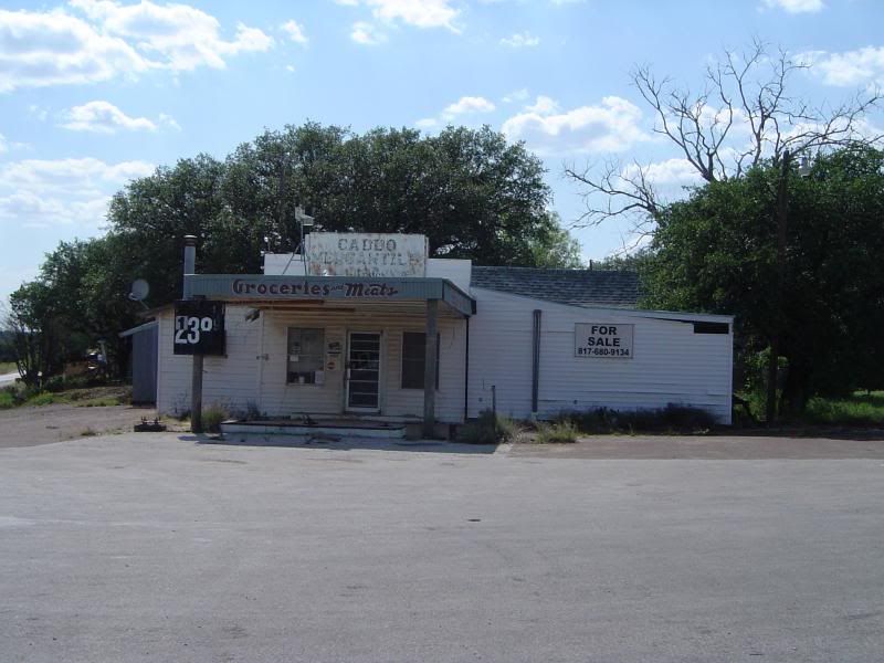
The Caddo Mercantile building located "at the Y" formed by US 180 and Loop 252 on the southeastern edge of town
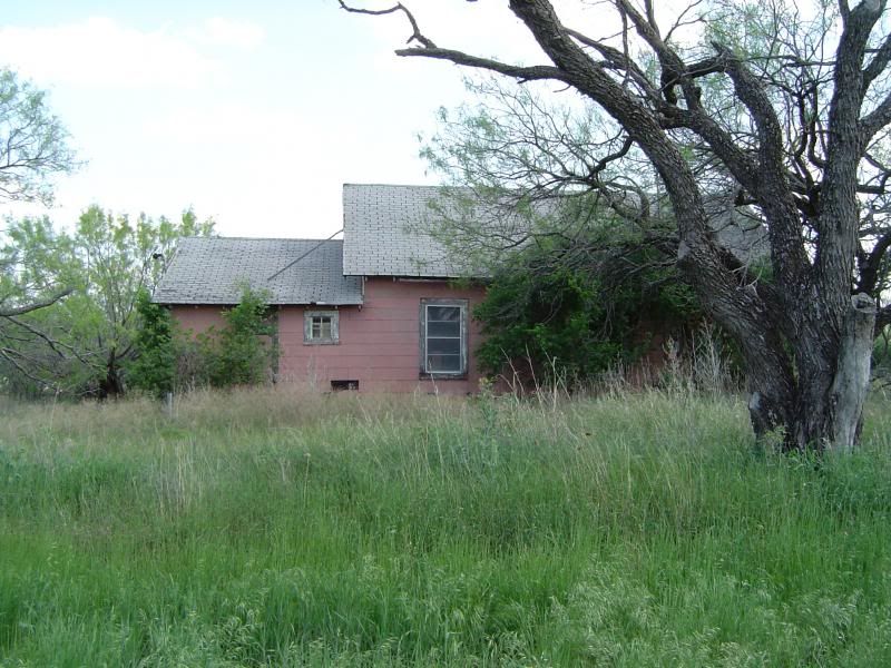
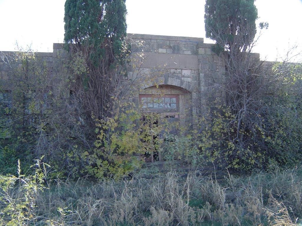
An old house at Caddo, apparently abandoned
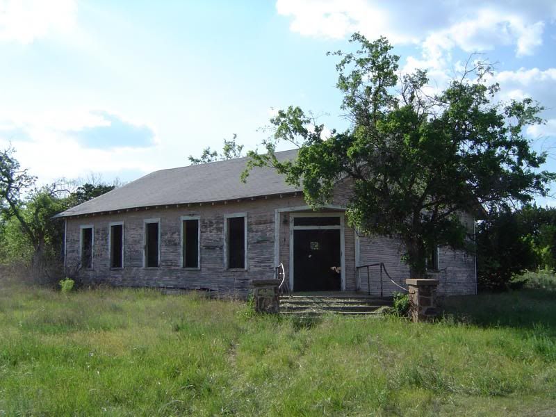
A "ghost church" at Caddo with pews still remaining inside, now apparently used for farm storage
While World War I raged in Europe, wildcatters were combing through various Texas sites in search of promising oil wells. One such entrepreneur hit paydirt in May 1916 in the vicinity of Caddo, drilling a 2,740-foot well on the farmland of W.L. Carey that produced a modest amount of oil. Soon, more oil wells began to spring up around Stephens County, with Texas Pacific Coal & Oil Company drilling its own well in the Caddo region as well - potentially bad news for the nearby Erath County town of Thurber, a company town of 10,000 that depended on bituminous coal mining and brickmaking to stay alive. Caddo was the first town to reap the benefits of the oil boom, and the town's population quickly swelled to 1,000 by 1920.
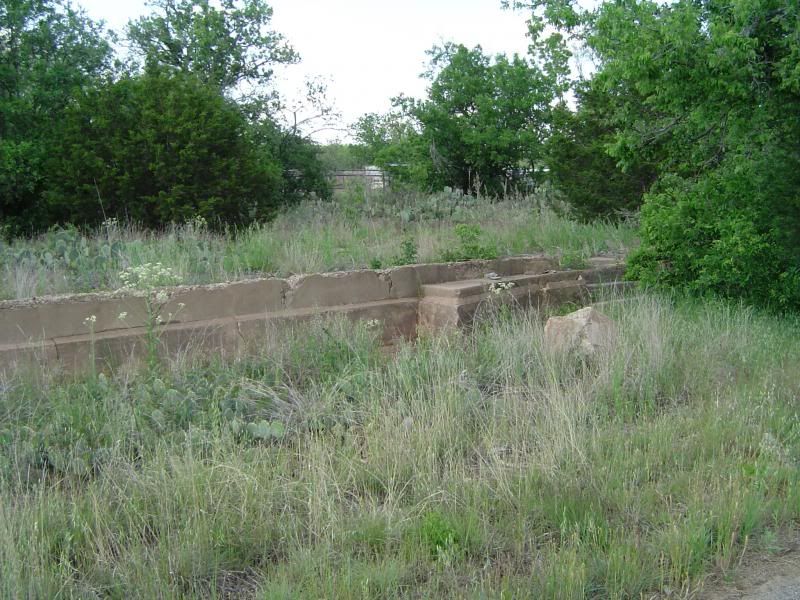
Stone foundations for a defunct Ford Motor Company dealership in Caddo from the 1930s - note the front steps to the right
The Caddo Post Office, still in operation
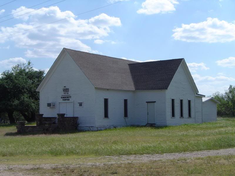
A former church in Caddo, now a community center and headquarters for the Caddo VFD
There were other oil discoveries in nearby Breckenridge as well as Ranger, and both towns started to grow dramatically, which may have contributed to Caddo's eventual decline. Still, Caddo managed to maintain a healthy population of 600 until 1940; during World War II and the postwar era, the population plummeted and never recovered. Today, a maximum of 40 residents call Caddo home.
Crumpled ruins of a house off Loop 252 in Caddo
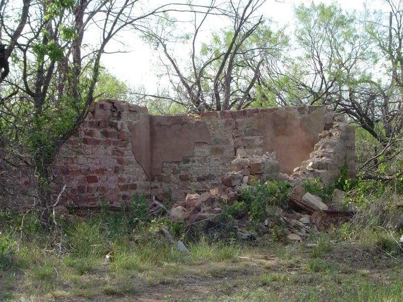
Stone walls from a crumbling building on a county road in Caddo
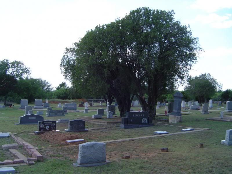
A cross-section of graves at Caddo Cemetery - lots of Confederate flags planted to honor those born before or during the Civil War
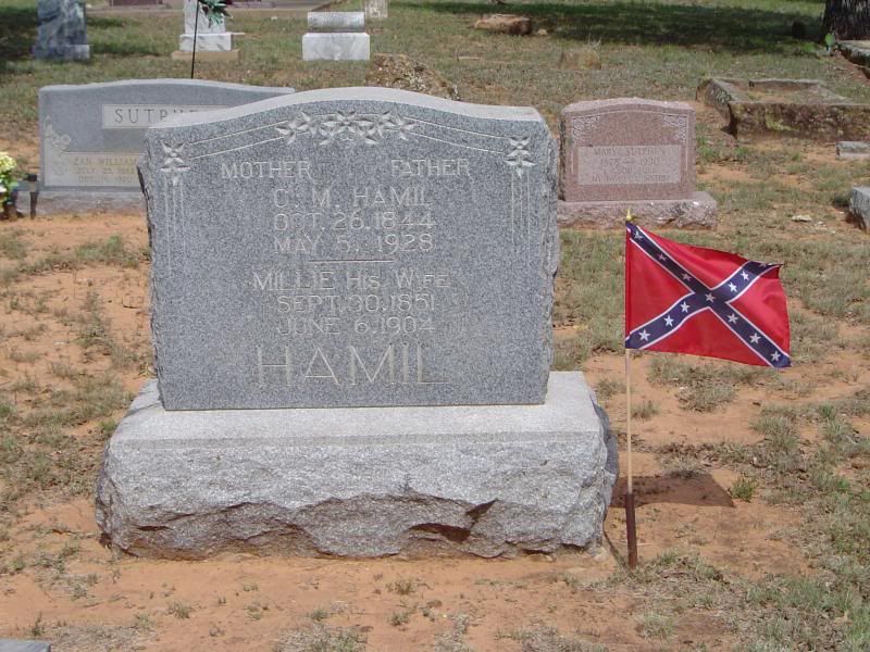
Resting place of C.M. and Millie Hamil
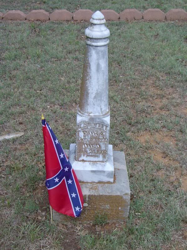
Grave marker for L. Shoffit
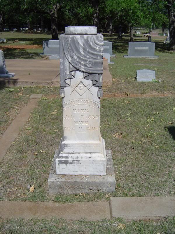
Masonic tombstone for John H. Patton
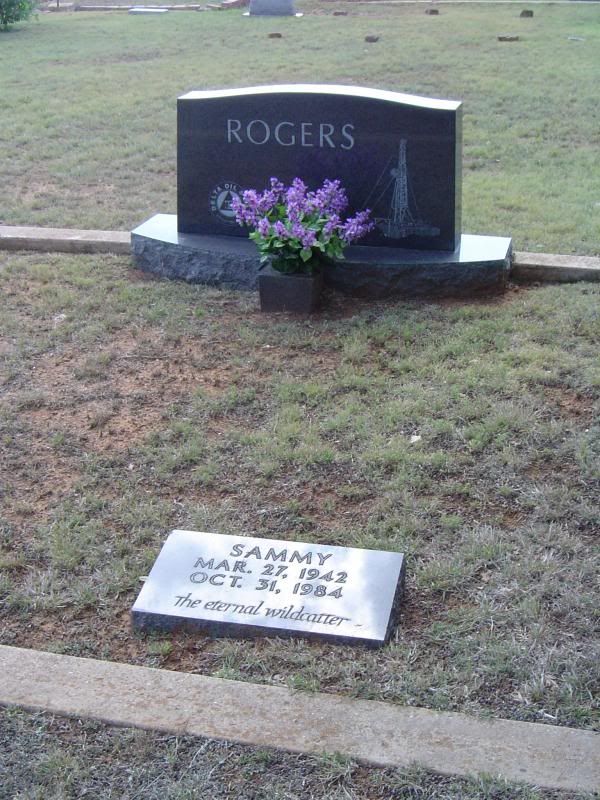
Memorial for Delta Oil & Gas wildcatter Sammy Rogers
Aside from the post office, which continues operation to this day, the only other business in Caddo appears to be oilwell operations by Delta Oil & Gas, based out of Breckenridge. The Caddo Mercantile building, once a convenient source of gas and groceries for the town, has been closed for some time, and the current property owner is looking to sell the building (current asking price: $119,000). Some of the folks at Caddo say a lot of the town's history is sealed up in the mercantile building, but for now it remains off limits. They're also hoping to bring in a few more people from the surrounding area to make Caddo their new home, especially with some new uncertainty over the future of commerce and development in Breckenridge. Caddo is a quiet little ghost town today, but given its location and the circumstances of nearby communities, the folks I met at Caddo told me it could all change before I knew it - signs of life and opportunity still persist in the heart of Caddo today.
Almost a hundred years ago, the Stephens County town of Caddo was growing with the promise of new industry and wealth. Today, it is one of those places I can travel to if I need to get away from all the sounds of mankind and the civilization we have created. Located on the at the intersection of US Highway 180 and State Park Road 33 about 10 miles east of Breckenridge, Caddo is peaceful, quiet, and a shell of its former self.
I would have liked to share a photo of the historical marker of Caddo with you, but the marker has somehow gone missing, so I gathered pieces of the town's history from the Texas State Historical Association as well as conversations with some of the town's residents. (Thanks for the eggs, guys!)
The town was established sometime in the late 1870s on what used to be a Caddo campsite - hence the name - and soon the settlement started growing steadily, with 60 residents in 1880, 75 in 1890, and 149 in 1900. At this point, Caddo featured at least two churches as well as a school and a post office.

The Caddo Mercantile building located "at the Y" formed by US 180 and Loop 252 on the southeastern edge of town

An old house at Caddo, apparently abandoned

A "ghost church" at Caddo with pews still remaining inside, now apparently used for farm storage
While World War I raged in Europe, wildcatters were combing through various Texas sites in search of promising oil wells. One such entrepreneur hit paydirt in May 1916 in the vicinity of Caddo, drilling a 2,740-foot well on the farmland of W.L. Carey that produced a modest amount of oil. Soon, more oil wells began to spring up around Stephens County, with Texas Pacific Coal & Oil Company drilling its own well in the Caddo region as well - potentially bad news for the nearby Erath County town of Thurber, a company town of 10,000 that depended on bituminous coal mining and brickmaking to stay alive. Caddo was the first town to reap the benefits of the oil boom, and the town's population quickly swelled to 1,000 by 1920.

Stone foundations for a defunct Ford Motor Company dealership in Caddo from the 1930s - note the front steps to the right

The Caddo Post Office, still in operation

A former church in Caddo, now a community center and headquarters for the Caddo VFD
There were other oil discoveries in nearby Breckenridge as well as Ranger, and both towns started to grow dramatically, which may have contributed to Caddo's eventual decline. Still, Caddo managed to maintain a healthy population of 600 until 1940; during World War II and the postwar era, the population plummeted and never recovered. Today, a maximum of 40 residents call Caddo home.

Crumpled ruins of a house off Loop 252 in Caddo

Stone walls from a crumbling building on a county road in Caddo

A cross-section of graves at Caddo Cemetery - lots of Confederate flags planted to honor those born before or during the Civil War

Resting place of C.M. and Millie Hamil

Grave marker for L. Shoffit

Masonic tombstone for John H. Patton

Memorial for Delta Oil & Gas wildcatter Sammy Rogers
Aside from the post office, which continues operation to this day, the only other business in Caddo appears to be oilwell operations by Delta Oil & Gas, based out of Breckenridge. The Caddo Mercantile building, once a convenient source of gas and groceries for the town, has been closed for some time, and the current property owner is looking to sell the building (current asking price: $119,000). Some of the folks at Caddo say a lot of the town's history is sealed up in the mercantile building, but for now it remains off limits. They're also hoping to bring in a few more people from the surrounding area to make Caddo their new home, especially with some new uncertainty over the future of commerce and development in Breckenridge. Caddo is a quiet little ghost town today, but given its location and the circumstances of nearby communities, the folks I met at Caddo told me it could all change before I knew it - signs of life and opportunity still persist in the heart of Caddo today.
Monday, May 6, 2013
A long-overdue update on Bankersmith
Sorry about the delay in posting, folks, but those 50-hour workweeks tend to sap you of your free time. I did want to share with you, however, this article from the San Antonio Express-News concerning last year's alleged purchase of the Hill Country ghost town of Bankersmith by Bikinis magnate Doug Guller. Among other developments, it appears that there are remains of the town itself, including the old post office and general store. Check it out.
Thursday, March 21, 2013
Ireland (Coryell County/Hamilton County) - March 2013 photos
A lot of communities in Texas became ghost towns because railroad tracks were never laid anywhere in the vicinity of these sites. Ireland, however, is an example of a town that gained a railroad, then lost it.
Ireland, which straddles the Coryell/Hamilton county line about 16 miles northwest of Gatesville, got its start as the rural community of Hamco, which took its name from the first letters of each county. In 1911, however, the St. Louis Southwestern Railway Company (better known as the Cotton Belt Railway) ran a line between Gatesville and Hamilton that ran right through Hamco, which blossomed into an actual town through the work of the Mid-Texas Improvement Company. The locals then petitioned for a post office to be named in honor of John Ireland, a former Texas governor. The post office was granted, and Ireland was born in earnest.
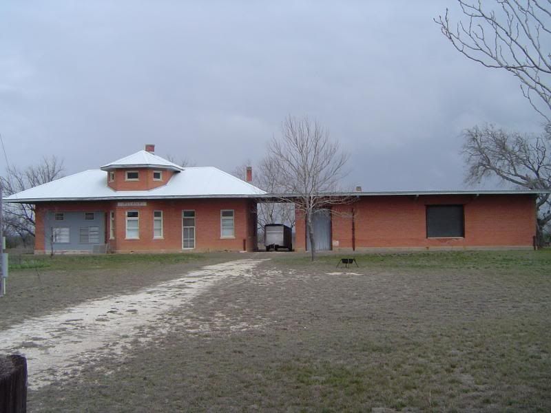 The handsome train depot at Ireland, now on private farmland
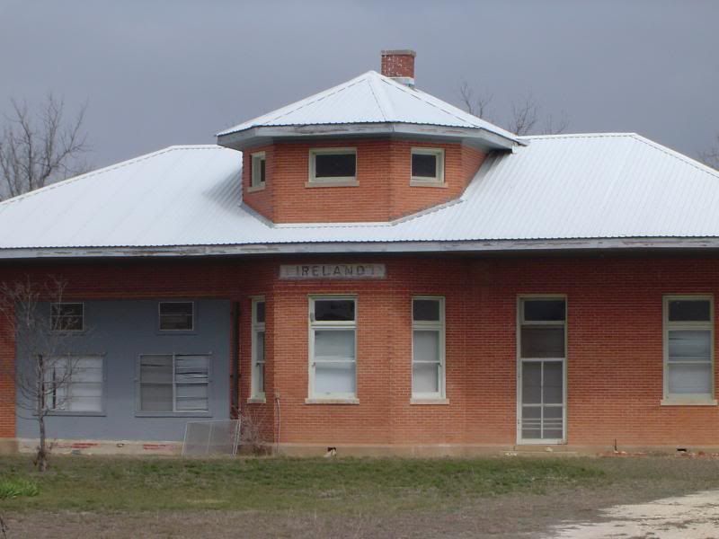 A closer look at the depot
The new town attracted cotton farmers who were eager to sell their crops to European nations, where World War I drove up prices for agricultural commodities. Ireland's population swelled to 400 by 1921, when a two-story brick schoolhouse was built on the county line to replace its previous wooden frame schoolhouse. In addition to the school, Ireland now boasted a bank (also two stories) with $20,000 of capital stock and a chamber of commerce as well as three churches, three general stores, a drug store, a restaurant, and several other businesses.
 A general store in downtown Ireland
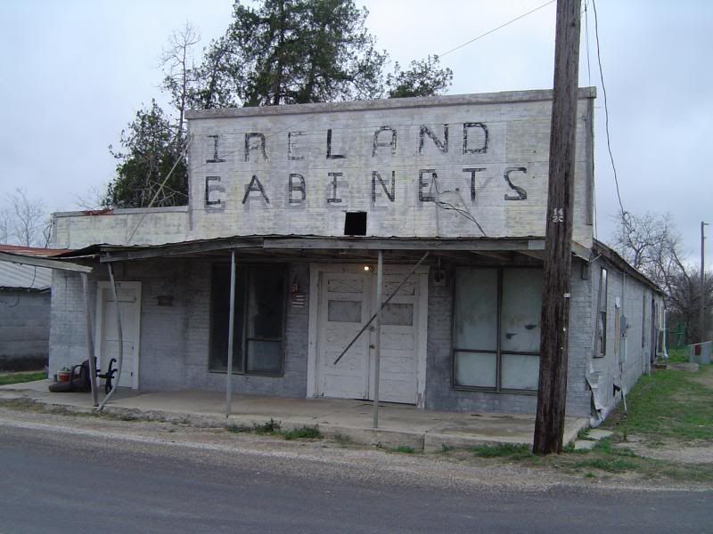
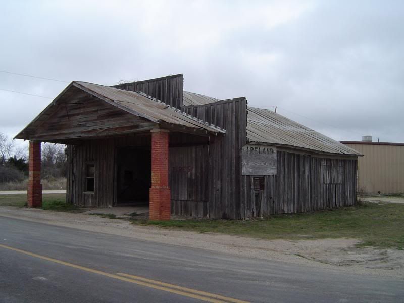 Another general store that converted into a gas station
Unfortunately for Ireland, agricultural prices collapsed in 1921, making it harder for farmers to realize a profit on their crops. Then the Great Depression hit in 1929, and Ireland's downward spiral was now unstoppable. Families who couldn't sell their land often had it foreclosed by the banks. The Cotton Belt Railway stopped passenger service to Ireland in 1936, finally pulling up its tracks in 1942. By the end of World War II, only 40 residents remained.
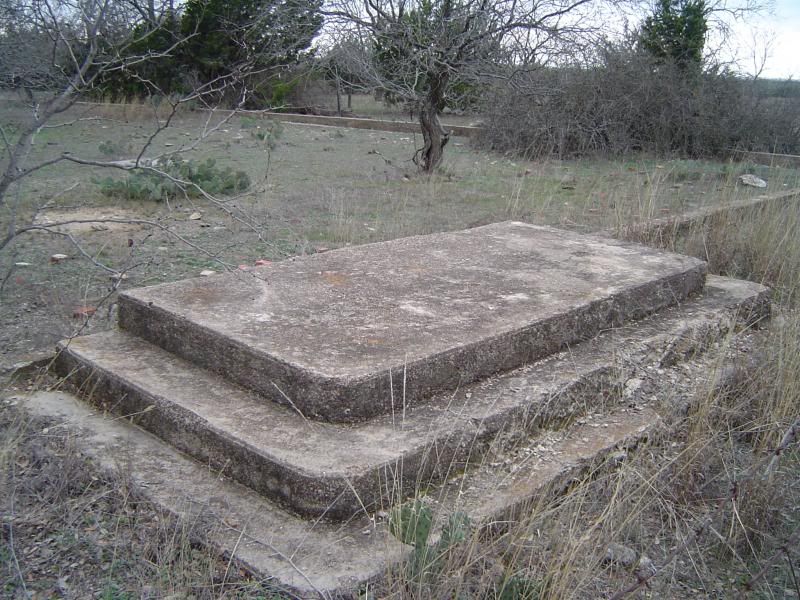
 Foundations and vault of the bank in Ireland
 A closer look at the vault
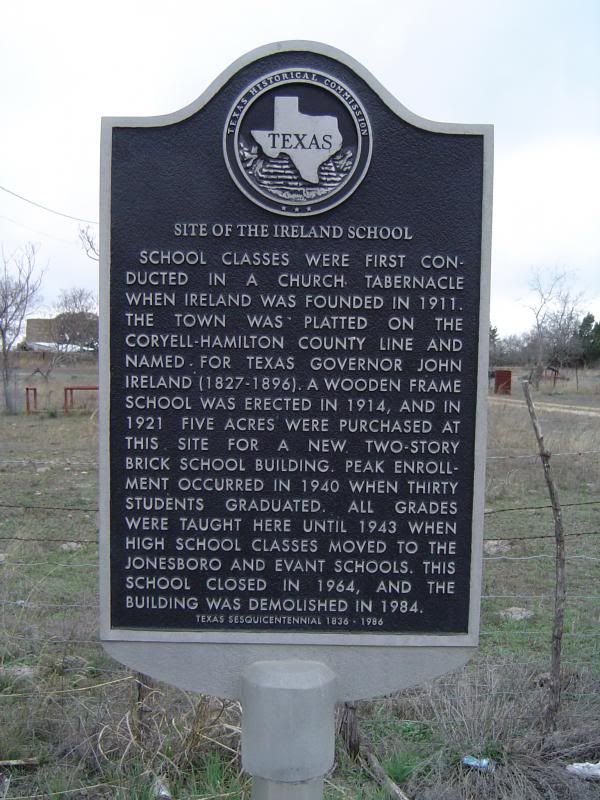 Historical marker designating the location of the schoolhouse, which was finally demolished in 1984
 Front steps and foundations of the school, now on private property (Thanks to Jamye Carr for discovering this)
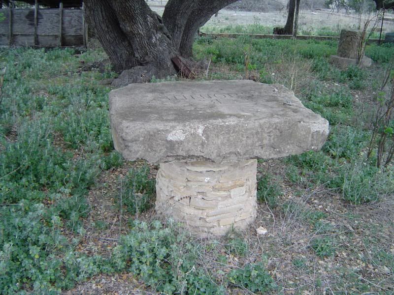 Table inscribed with JUNIORS 31 just outside the school (Thanks again, Jamye)
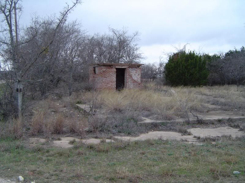
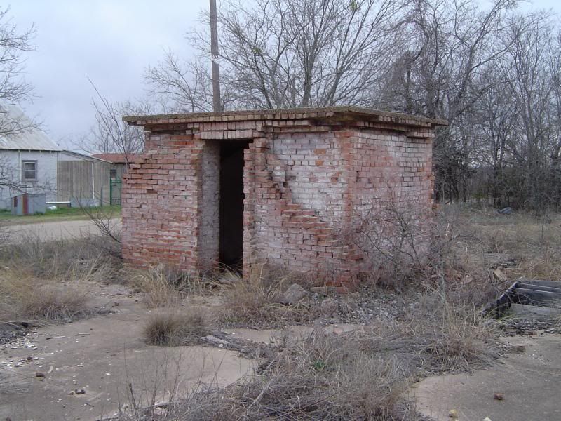
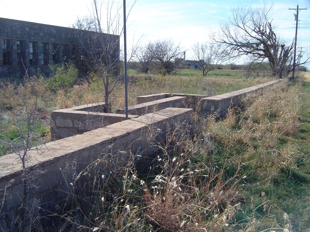
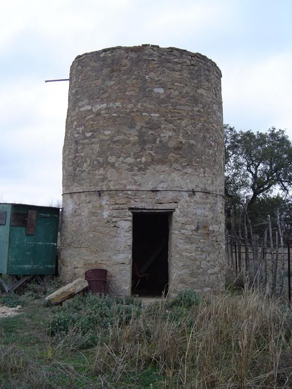 A water cistern (?) behind what may have been a gymnasium for the school
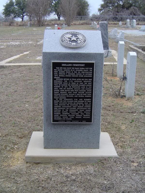 A state marker at Ireland Cemetery
 This tree stands vigil over Ireland's dearly departed
 Various gravestones at Ireland Cemetery
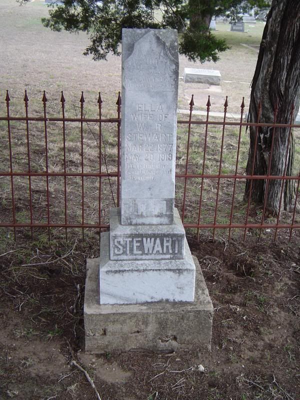 Resting place of Ella Stewart, wife of W.R. Stewart
Ireland's post office managed to linger on until 1970, when it became a rural branch of the Gatesville service. The population grew to 60 in 1990 and stayed there for at least 10 years. A recent estimate says that there may now only be 20 people living at the townsite. One of the churches has also been converted into a private residence.
Today, Ireland is a quiet place, farmed and ranched by the few diehards who stayed behind, and friendly dogs play amongst the building foundations that straddle Farm Road 932 on the county line. Jamye and I truly enjoyed our visit to this once-promising Texas ghost town, built on cotton and the railroad, but doomed by outside forces beyond its control.
Ireland, which straddles the Coryell/Hamilton county line about 16 miles northwest of Gatesville, got its start as the rural community of Hamco, which took its name from the first letters of each county. In 1911, however, the St. Louis Southwestern Railway Company (better known as the Cotton Belt Railway) ran a line between Gatesville and Hamilton that ran right through Hamco, which blossomed into an actual town through the work of the Mid-Texas Improvement Company. The locals then petitioned for a post office to be named in honor of John Ireland, a former Texas governor. The post office was granted, and Ireland was born in earnest.
 The handsome train depot at Ireland, now on private farmland
 A closer look at the depot
The new town attracted cotton farmers who were eager to sell their crops to European nations, where World War I drove up prices for agricultural commodities. Ireland's population swelled to 400 by 1921, when a two-story brick schoolhouse was built on the county line to replace its previous wooden frame schoolhouse. In addition to the school, Ireland now boasted a bank (also two stories) with $20,000 of capital stock and a chamber of commerce as well as three churches, three general stores, a drug store, a restaurant, and several other businesses.
 A general store in downtown Ireland
 Another general store that converted into a gas station
Unfortunately for Ireland, agricultural prices collapsed in 1921, making it harder for farmers to realize a profit on their crops. Then the Great Depression hit in 1929, and Ireland's downward spiral was now unstoppable. Families who couldn't sell their land often had it foreclosed by the banks. The Cotton Belt Railway stopped passenger service to Ireland in 1936, finally pulling up its tracks in 1942. By the end of World War II, only 40 residents remained.
 Foundations and vault of the bank in Ireland
 A closer look at the vault
 Historical marker designating the location of the schoolhouse, which was finally demolished in 1984
 Front steps and foundations of the school, now on private property (Thanks to Jamye Carr for discovering this)
 Table inscribed with JUNIORS 31 just outside the school (Thanks again, Jamye)
 A water cistern (?) behind what may have been a gymnasium for the school
 A state marker at Ireland Cemetery
 This tree stands vigil over Ireland's dearly departed
 Various gravestones at Ireland Cemetery
 Resting place of Ella Stewart, wife of W.R. Stewart
Ireland's post office managed to linger on until 1970, when it became a rural branch of the Gatesville service. The population grew to 60 in 1990 and stayed there for at least 10 years. A recent estimate says that there may now only be 20 people living at the townsite. One of the churches has also been converted into a private residence.
Today, Ireland is a quiet place, farmed and ranched by the few diehards who stayed behind, and friendly dogs play amongst the building foundations that straddle Farm Road 932 on the county line. Jamye and I truly enjoyed our visit to this once-promising Texas ghost town, built on cotton and the railroad, but doomed by outside forces beyond its control.
Saturday, March 9, 2013
Exploring ghost towns - with a friend
Phew! I just got back in town from Coryell County, where I've been running around for the better part of Saturday with my friend Jamye Carr. We had a lot of fun exploring The Grove, which I visited before back in August of 2010, but this was Jamye's first time to visit this historic and picturesque Hill Country ghost town. And yes, the town well still has water in it to this day. We made sure to check closely this time.
Afterwards, we paid a visit to Ireland, which straddles both Coryell County and Hamilton County. We discovered the downtown area, the cemetery, and the remains of the historic school in Ireland. (It must have been historic - Texas erected a historical marker in its memory.)
I'm very happy that this was my first ghost town expedition with a running buddy, and we're already looking forward to our next expedition together. I will share my photos from Ireland soon, but as many of you know, I've been swamped with work and other commitments lately, and right now I'm just flat out tired. Going home to relax and adjust myself to Daylight Savings Time. Spring forward, remember?
Have a great weekend, everyone!
Saturday, January 12, 2013
Experience the sounds of a ghost town - without leaving your keyboard
I want to try something a little different, and I hope you enjoy it.
Last month, I took a microphone out to Gilliland in Knox County during my visit to the ghost town, and I made some field recordings while snapping pictures. When I got home, I did some research into music that suited the frame of mind that Gilliland put me in as explored the site, trying to capture just the right moods. I then mixed the music and field recordings together, boiled it down into a stereo mix, and voila! My first attempt at an audio ghost town essay.
Click here to listen on Mixcloud if you're interested in checking it out. The entire piece runs for a little under 50 minutes. Listen at home, at work, in your car, wherever you feel the need for some minimal, contemplative music.
As a shameless plug, the Mixcloud suite also features a performance by my good friend, Laura Ainsworth. Click here to visit Laura's website or to learn about her debut album, Keep It To Yourself. You can also click here to follow Laura's Twitter feed. The mix also includes performances by Stars of the Lid, Rafael Anton Irisarri, and many more.
I hope to do more of these in the future, and unlike this blog, the "Ghost Town Essays" might not be restricted to Texas sites. There are other fascinating abandoned towns all across the Southwest, and I would also love to set foot one day in the perpetually smoldering mining ghost town of Centralia, Pennsylvania - that would make for a compelling audio project.
Thursday, December 27, 2012
Obligatory holiday ghost town photo!
Taken at the townsite of Silver Lake on December 26, 2012. This old gas station sits close to the line that divides Van Zandt County and Smith County, which Silver Lake straddles.
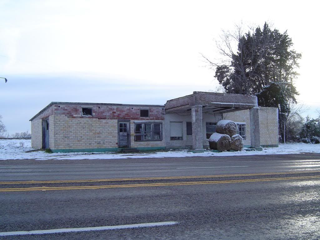
I'll present a more complete picture of Silver Lake real soon. Best wishes to everyone for a happy and peaceful New Year!

I'll present a more complete picture of Silver Lake real soon. Best wishes to everyone for a happy and peaceful New Year!
Wednesday, December 19, 2012
La Reunion - A different sort of expedition
If you haven't checked out the December 19 edition of The Dallas Morning News yet, take a look at this article.
Joe Ramirez has been in contact with me a couple of times looking for the scant remains of the La Reunion ghost town west of downtown Dallas, and when he came across what might be the old DeLord homestead, he found he found the site in disarray just as I had in March. Suspecting that the site was being used as a meth lab, Joe tried in vain to get various Dallas organizations to pay attention to the old colony site.
That's when Joe led a small expedition to the DeLord homestead, as recorded in The Dallas Morning News.
I don't want to spoil the story, and besides, the paper would appreciate a few more on-line visitors. But please read it - the article's not too terribly long.
I'm happy that this blog played some part in shining light on a forgotten chapter of Dallas' history, and I'm proud of Joe for staying on the case and not letting this site fall through the cracks.
Monday, December 3, 2012
Gilliland (Knox County) - December 2012 photos
Some ghost towns in Texas have long and detailed histories replete with tales of ambition, grandeur, innovation, and sometimes lawlessness and mayhem. And then there are ghost towns like Gilliland, which is located on Farm Road 1756 in north central Knox County, within an hour's drive from the Panhandle.
Downtown Gilliland today
Located smack dab in the middle of nowhere, Gilliland never grew to any great size - boasting a reported peak of 120 residents in 1947 - but those that called Gilliland home worked hard to build it into a community that could take care of itself. The first white settlers to put down roots here established a community called Coyote, and their efforts managed to attract some Norwegian families from Bosque County, who migrated to Coyote in 1890. The community established its own school district on May 1, 1892, and opened the doors of its school in 1895, with Oma Aker serving as the community's first teacher. When Coyote resident O.M. Olson opened a post office inside his home in 1907, the post office was named after district judge W.A. Gilliland, and the name quickly stuck to the town itself.
Abandoned and deteriorating general store at Gilliland
Remains of Gilliland's garage
A peek inside the disheveled garage
A cotton gin was built just outside Gilliland in 1910 and later modernized in 1936. Gilliland's population grew from 50 in 1925 to 120 in 1947, with the school, four businesses and one church serving the town's needs.
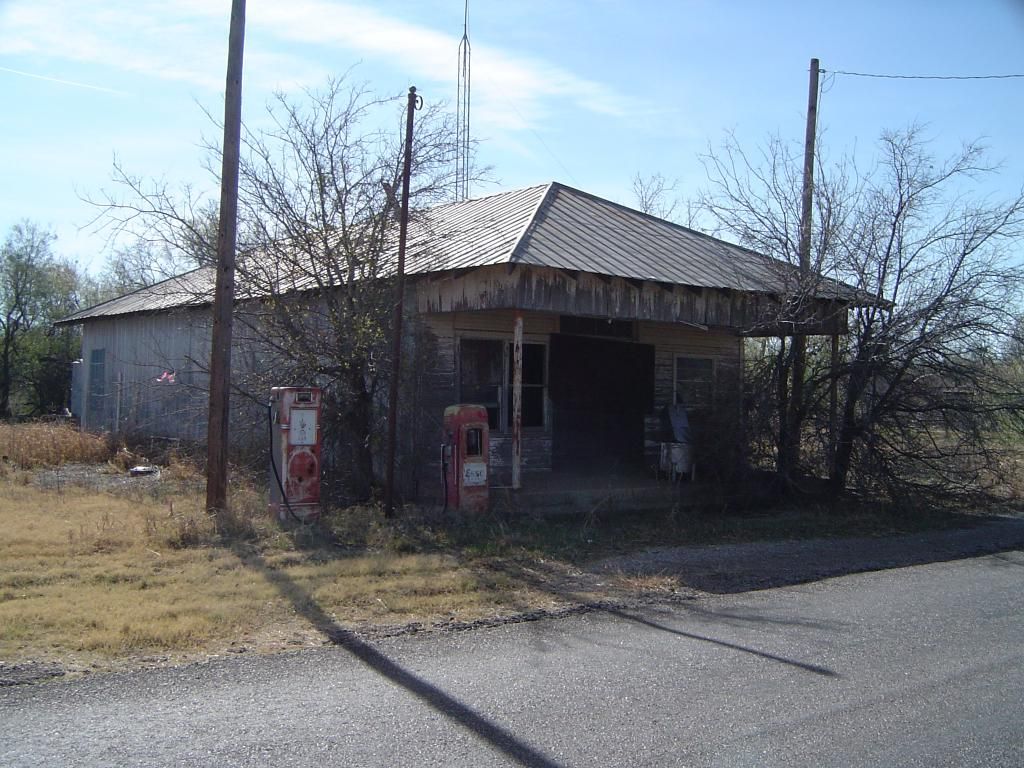
Gilliland's abandoned gas station and grocery
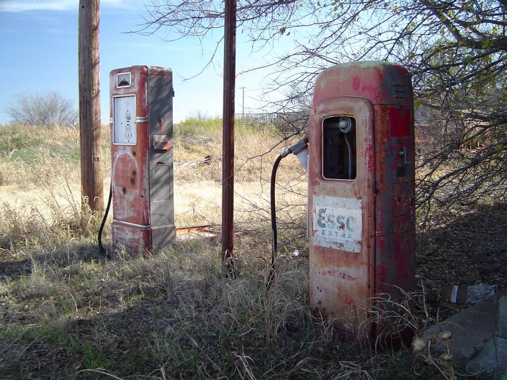
Closer look at the rusting Esso gasoline pumps (today, Esso is known as ExxonMobil)
One of numerous derelict houses in Gilliland being reclaimed by the elements
The most important building in Gilliland appears to have been its school. Although small compared to many modern school buildings in Texas today, Gilliland's school featured numerous classrooms, a cafeteria, and a gymnasium that doubled as an auditorium for plays and assemblies. Over the years, the school absorbed other schools in the region, which undoubtedly contributed to the town's growth. In 1948, however, it was Gilliland's turn. The town's high school was transferred to the city of Munday, some 20 miles south of Gilliland, leaving the town with only a grade school that continued to operate until the school itself was closed down in 1975.
Gilliland's school building as seen from the rear
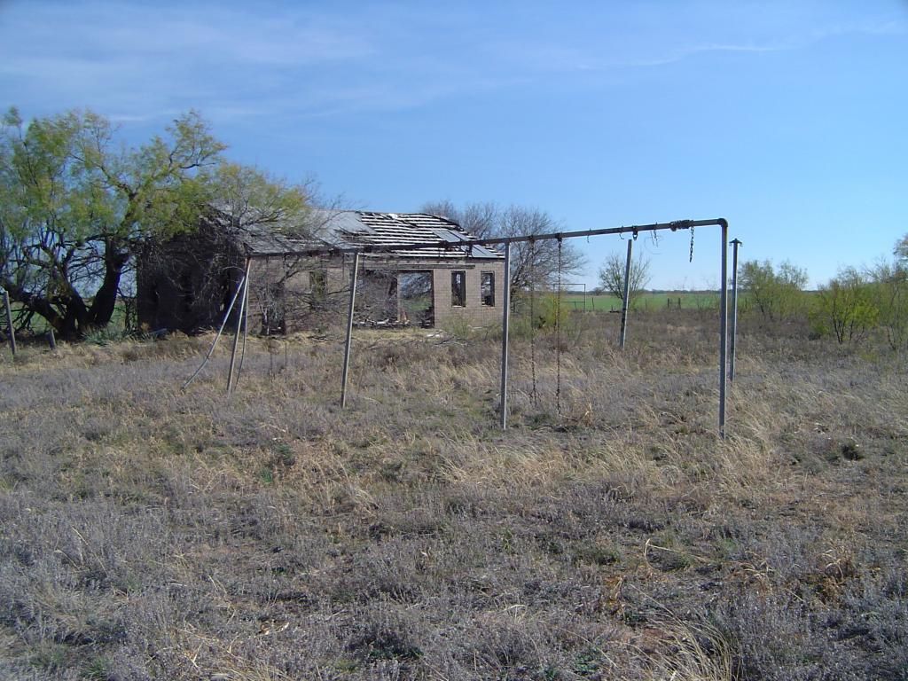 Weatherbeaten swingset at the Gilliland school
 Ingenious front gate to Gilliland's school - students can fit through, but cattle cannot
 Front door to Gilliland's school building
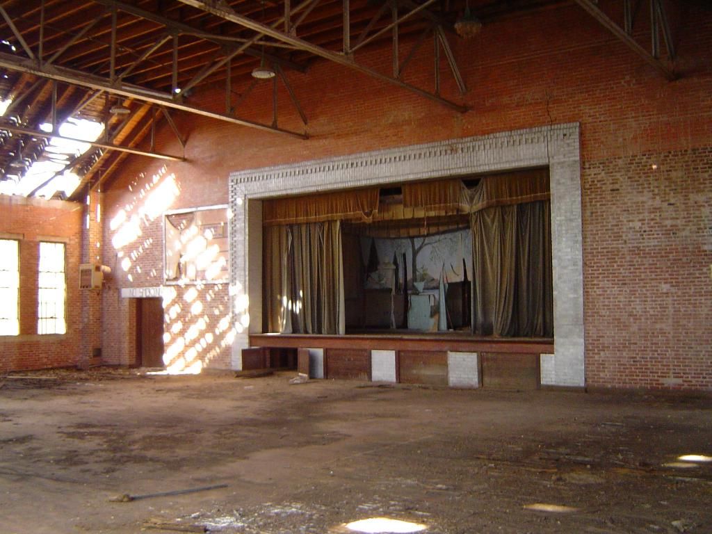
Stage in the gymnasium, still outfitted for a school play
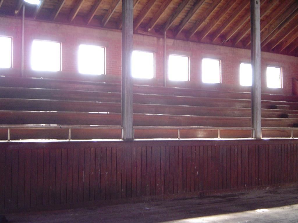
Bleachers in the gymnasium
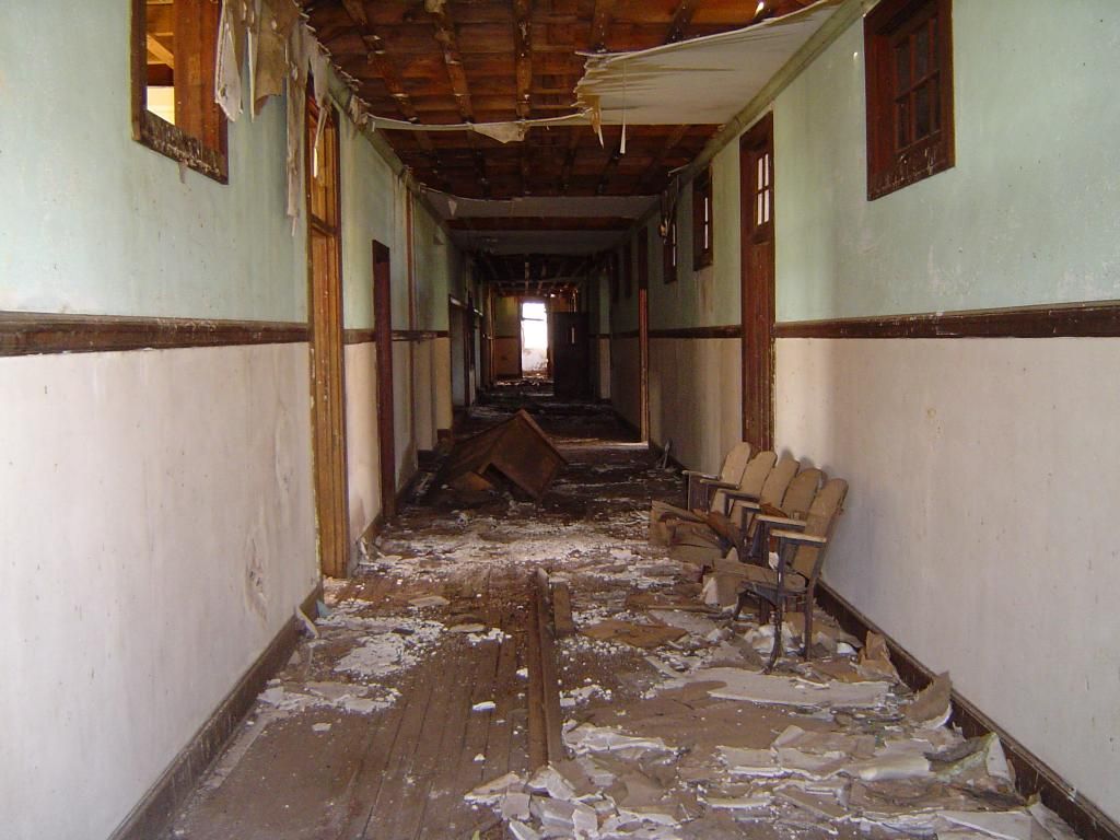
Hallway between classes with rotting and deteriorating floor - walking on the floorboards is NOT recommended
The closing of Gilliland's school appears to mirror the fortunes of the town itself; in 1990, the population was reported as 103, but ten years later, the number plunged to only 25. Today, there may be even fewer than that.
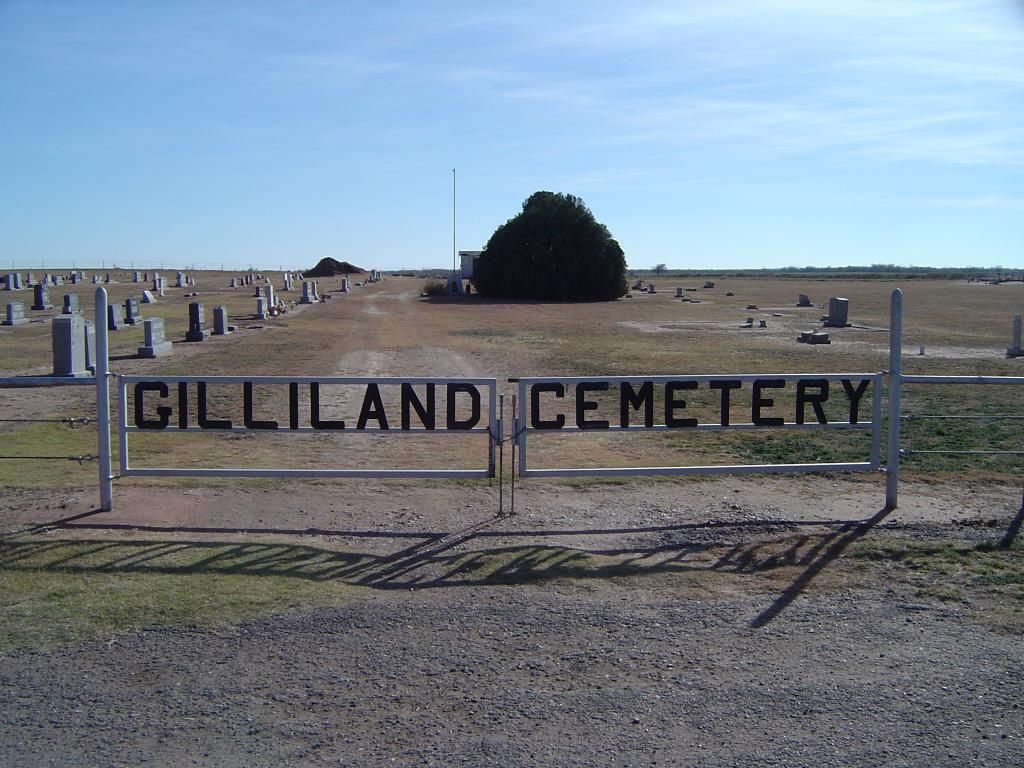
Front gate to Gilliland Cemetery
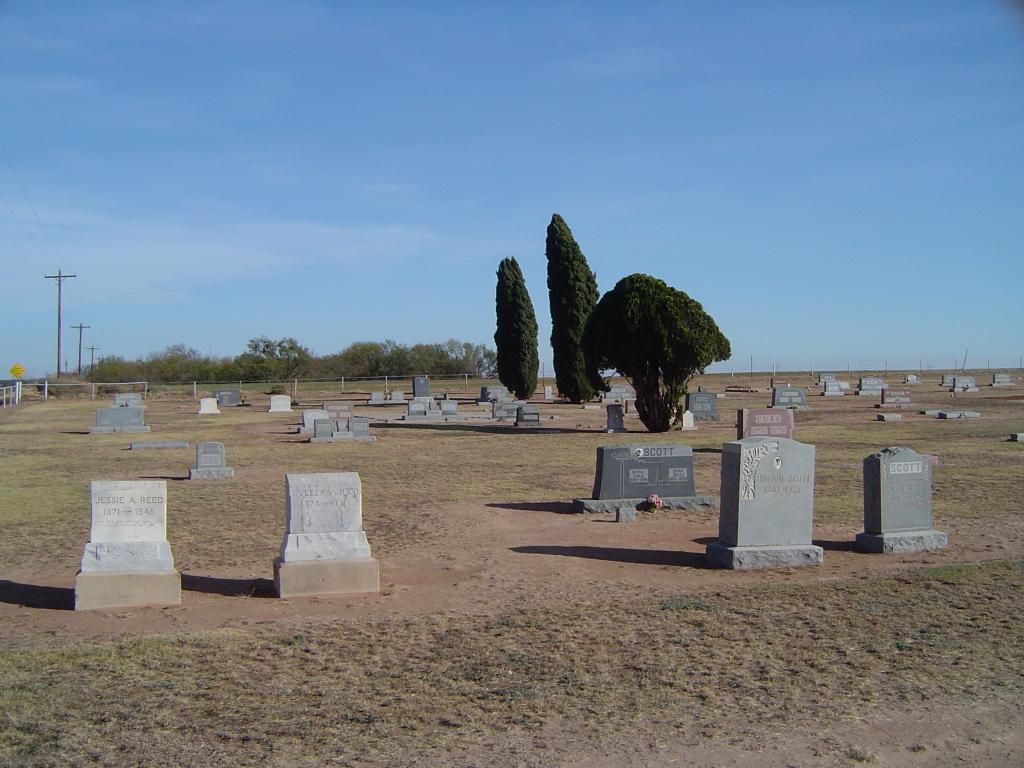
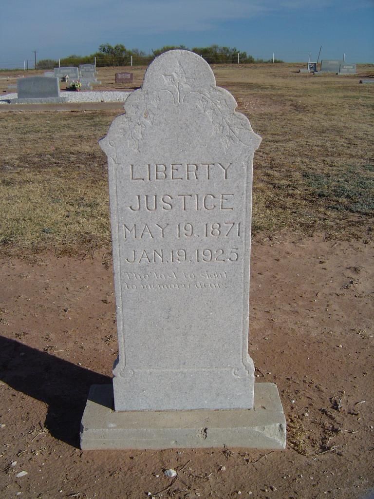
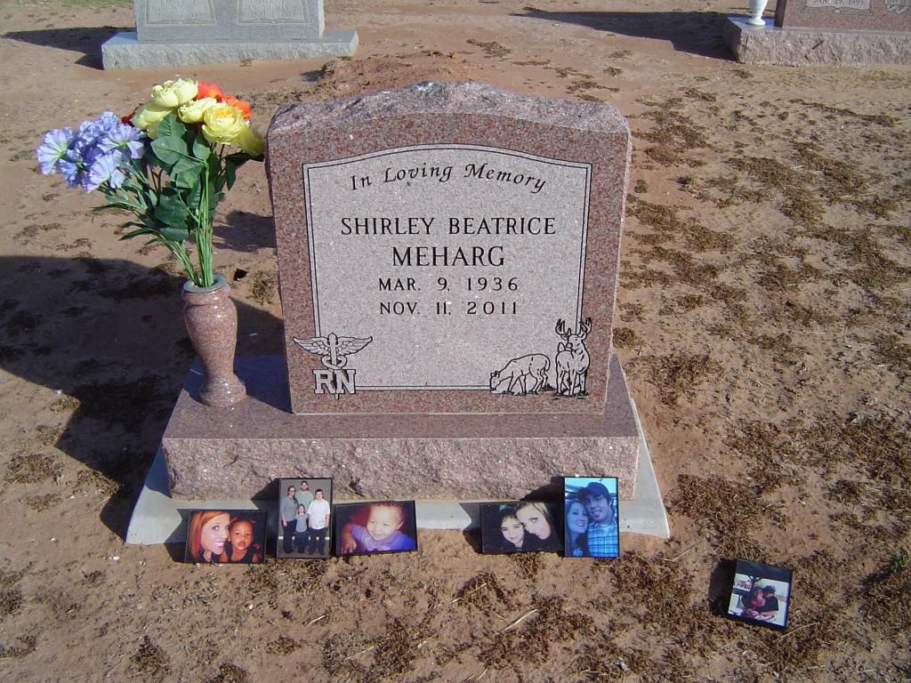
Some of the numerous graves at the cemetery
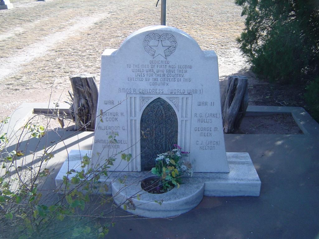
Memorial to World War I and World War II veterans at the cemetery
One of Gilliland's denizens had a striking name
Tombstone for a nurse
Gilliland Cemetery is approaching its sesquicentennial, and unfortunately some of the older gravestones have been damaged or disappeared completely. A couple of graves caught my eye in the far corner of the cemetery - the only known African-Americans buried in Gilliland. Whoever interred them apparently felt the need to not only isolate their graves from the general population at the cemetery, but also to stamp the word "Negro" on each of their headstones.
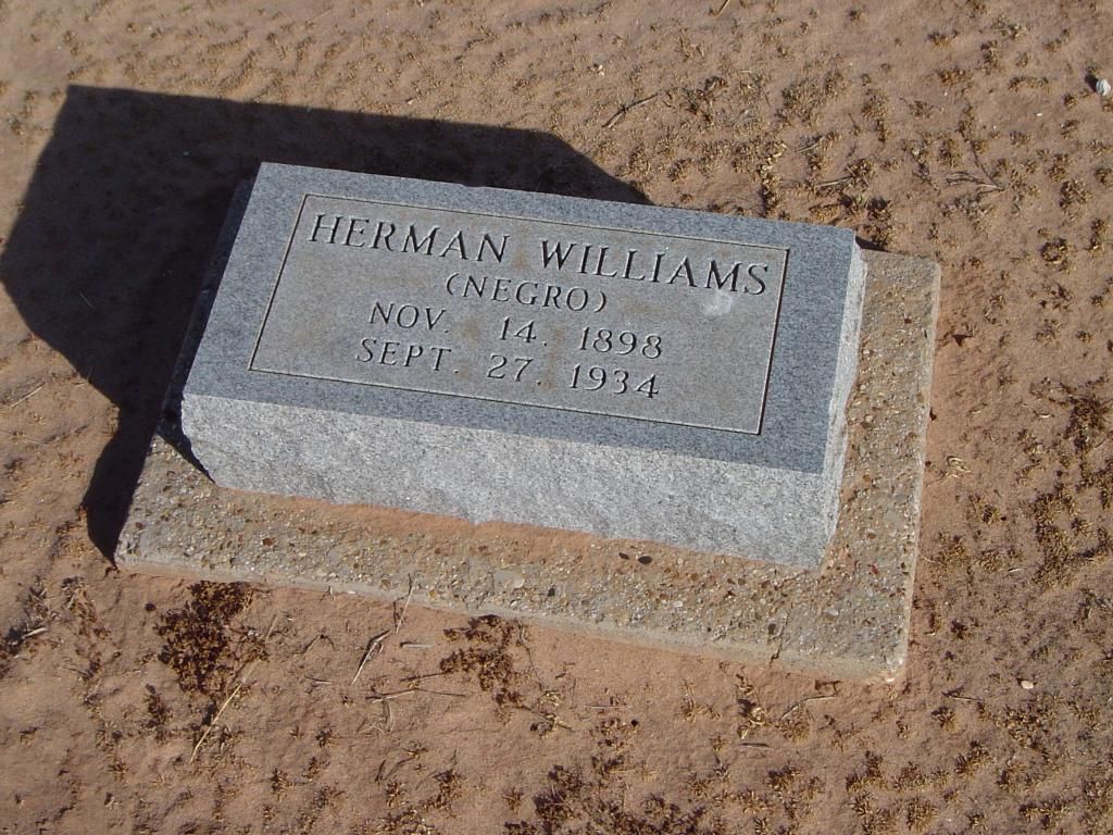
Grave marker for Herman Williams
Looking back at the photographs I took of Gilliland, while I am proud of the images I've been able to share with you, there were so many more images of the ghost town I could have captured. I've been looking forward to visiting Gilliland for a long time, and while the chances are remote that I will ever set foot in the townsite again, if I ever do, I will definitely have to grab more photos of this small but proud town nestled in the Rolling Plains, just southeast of the Panhandle. Sometimes, the best stories come out of the smallest towns, and in the case of towns such as Gilliland, it's not just a matter of what the town has built - but also what it has left behind.

Downtown Gilliland today
Located smack dab in the middle of nowhere, Gilliland never grew to any great size - boasting a reported peak of 120 residents in 1947 - but those that called Gilliland home worked hard to build it into a community that could take care of itself. The first white settlers to put down roots here established a community called Coyote, and their efforts managed to attract some Norwegian families from Bosque County, who migrated to Coyote in 1890. The community established its own school district on May 1, 1892, and opened the doors of its school in 1895, with Oma Aker serving as the community's first teacher. When Coyote resident O.M. Olson opened a post office inside his home in 1907, the post office was named after district judge W.A. Gilliland, and the name quickly stuck to the town itself.

Abandoned and deteriorating general store at Gilliland

Remains of Gilliland's garage

A peek inside the disheveled garage
A cotton gin was built just outside Gilliland in 1910 and later modernized in 1936. Gilliland's population grew from 50 in 1925 to 120 in 1947, with the school, four businesses and one church serving the town's needs.

Gilliland's abandoned gas station and grocery

Closer look at the rusting Esso gasoline pumps (today, Esso is known as ExxonMobil)

One of numerous derelict houses in Gilliland being reclaimed by the elements
The most important building in Gilliland appears to have been its school. Although small compared to many modern school buildings in Texas today, Gilliland's school featured numerous classrooms, a cafeteria, and a gymnasium that doubled as an auditorium for plays and assemblies. Over the years, the school absorbed other schools in the region, which undoubtedly contributed to the town's growth. In 1948, however, it was Gilliland's turn. The town's high school was transferred to the city of Munday, some 20 miles south of Gilliland, leaving the town with only a grade school that continued to operate until the school itself was closed down in 1975.

Gilliland's school building as seen from the rear
 Weatherbeaten swingset at the Gilliland school
 Ingenious front gate to Gilliland's school - students can fit through, but cattle cannot
 Front door to Gilliland's school building
Stage in the gymnasium, still outfitted for a school play

Bleachers in the gymnasium

Hallway between classes with rotting and deteriorating floor - walking on the floorboards is NOT recommended
The closing of Gilliland's school appears to mirror the fortunes of the town itself; in 1990, the population was reported as 103, but ten years later, the number plunged to only 25. Today, there may be even fewer than that.

Front gate to Gilliland Cemetery

Some of the numerous graves at the cemetery

Memorial to World War I and World War II veterans at the cemetery

One of Gilliland's denizens had a striking name

Tombstone for a nurse
Gilliland Cemetery is approaching its sesquicentennial, and unfortunately some of the older gravestones have been damaged or disappeared completely. A couple of graves caught my eye in the far corner of the cemetery - the only known African-Americans buried in Gilliland. Whoever interred them apparently felt the need to not only isolate their graves from the general population at the cemetery, but also to stamp the word "Negro" on each of their headstones.

Grave marker for Herman Williams
Looking back at the photographs I took of Gilliland, while I am proud of the images I've been able to share with you, there were so many more images of the ghost town I could have captured. I've been looking forward to visiting Gilliland for a long time, and while the chances are remote that I will ever set foot in the townsite again, if I ever do, I will definitely have to grab more photos of this small but proud town nestled in the Rolling Plains, just southeast of the Panhandle. Sometimes, the best stories come out of the smallest towns, and in the case of towns such as Gilliland, it's not just a matter of what the town has built - but also what it has left behind.
Subscribe to:
Posts (Atom)